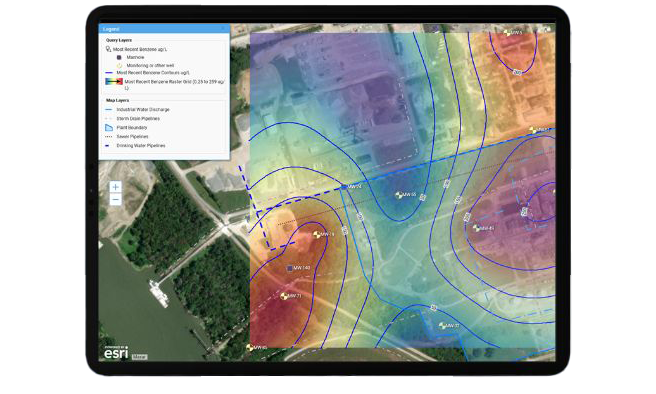
Water data is more powerful when tied to locations.
With integrated GIS, Locus Water software can map key assets and sample site locations. Spatial context helps utilities visualize trends and make informed compliance decisions.
Explore how GIS-enabled water data supports environmental compliance with geographic clarity.